
Take a Hike | Burton Peak
Big Views, Huckleberries, and a Bit of North Idaho History
Every summer, I start off with ambitious hiking plans—dreamy lists filled with alpine lakes, summit scrambles, and enough elevation gain to make my legs question my judgment. But just like my ever-growing hot springs list, the more I explore, the longer my “must-do” hikes become.
One trail that had been lingering on my list for a couple of years was Burton Peak, just north of Bonners Ferry. This summer, we finally made it happen.

The Hike
Burton Peak is a 5.2-mile out-and-back hike with just over 1,700 feet of elevation gain. I’d rate it as moderate to hard—it’s a steady climb from the trailhead to the summit, but the reward is more than worth the effort.
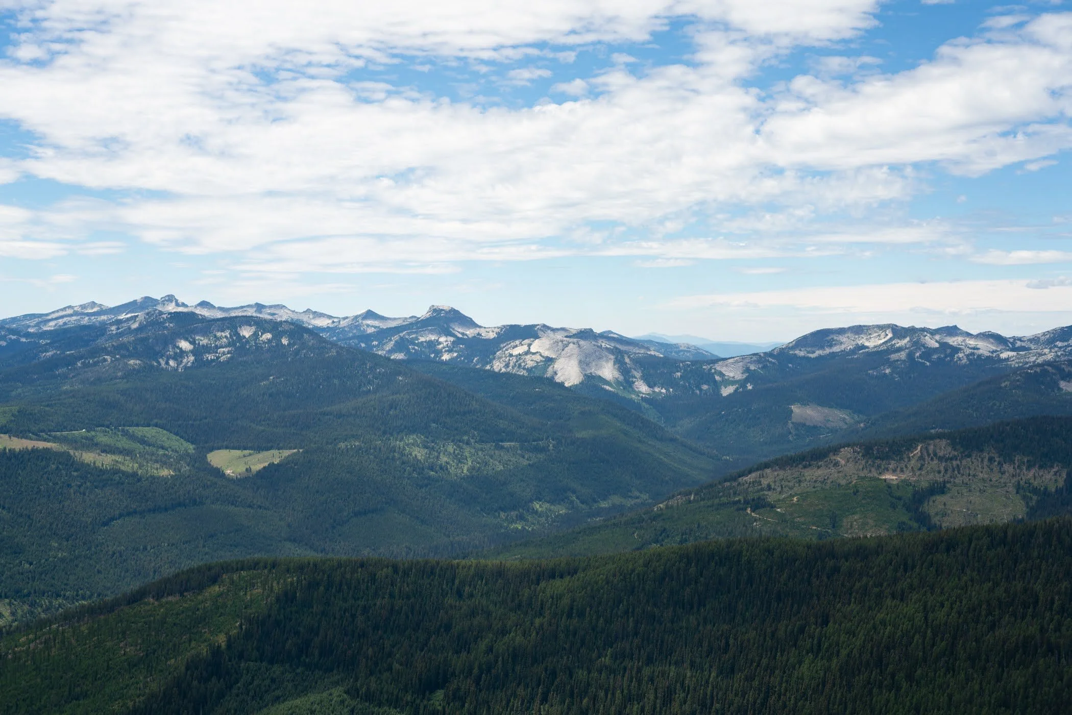
The trail begins in a dense, shaded forest and stays that way until about the 1.7-mile mark, when you break out onto an open, rocky ridgeline. From there, it’s blue skies, big views, and steady switchbacks all the way to the top.
At the summit (elevation 6,844 feet), you’re greeted with sweeping views of the Kootenai River Valley, along with the Cabinet and Purcell ranges. The Selkirks steal the show, though, with familiar peaks like Roman Nose, Lion’s Head, and Myrtle Peak all visible on a clear day.
And if you time your hike right—say, July through mid-August—you’ll be treated to abundant huckleberry patches along the trail. We filled a snack bag on our way down and probably could’ve filled a second. Rue has always been a berry fan, but on this outing, she finally figured out how to eat berries directly from the bush without help.

A Bit of History
At the top, you’ll also find the remains of an old fire lookout cabin. Originally built in 1933 and abandoned in 1967, the structure is now weather-beaten and collapsing in on itself. Unlike some historic lookouts in the region, this one isn’t safe to enter—but it’s still a cool reminder of the area’s past.
Though Burton Peak isn’t on the official route of the Pacific Northwest Trail, the long-distance path does wind through the general area, adding to the sense of wildness and adventure that permeates this part of North Idaho.

Why It’s Worth It
This trail checks a lot of boxes: it’s quiet, scenic, not crowded, and offers one of the best summit panoramas in the Bonners Ferry area. It’s also a good workout—enough uphill to feel accomplished, but not so grueling that it kills your legs for the rest of the week.
If you’re looking for a hike that delivers high reward for the climb (and maybe a pint of huckleberries to boot), Burton Peak is a great choice.
Getting There

Trailhead Directions
Coming from Sandpoint:
Head north on US-95 toward Bonners Ferry for approximately 30 miles.
About 1.5 miles before reaching Bonners Ferry, turn right onto Main Street (just before crossing the Kootenai River bridge).
Take an immediate right onto Riverside Road.
Continue on Riverside Road for 5 miles, then veer right onto Westside Road.
Follow Westside Road north for 1.5 miles, then turn left onto Myrtle Creek Road #633 and continue for another 1.5 miles.
Turn right onto Road #2411 and follow it to the junction with Road #2692. Turn right.
The trailhead is located at the end of Road #2692.
Important Note:
If you’re using a GPS app like AllTrails, be cautious—ours led us past Myrtle Creek Road #633 and into someone’s driveway about a quarter mile too far. Keep an eye on the road signs and consider bringing a trail map or downloading a PDF.
Final Thoughts

There’s something satisfying about finally crossing off a trail that’s lingered on your list for years. For me, Burton Peak was a reminder of why I keep adding hikes even as I “check them off”—there’s always something new to see, especially in this corner of North Idaho.